26/06/2024
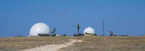
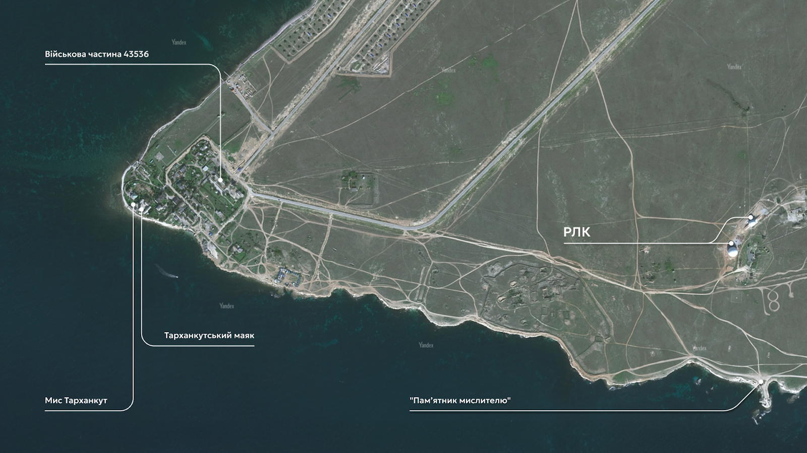
Having occupied Crimea, Russia has transformed it into a military base. One of the critical points is Cape Tarkhankut, which is on the peninsula's western coast. There, the occupiers set up a military facility, part of which was covered with white domes resembling golf balls. A similar setup exists on the summit of Ay Petri in the south of the peninsula. On May 13, 2024, an attack resulted in the death of a Russian commander.
How tourist photos near the "Thinker Monument" helped confirm the location of the Russian facility and understand that Russian radar systems are hidden under the domes at Cape Tarkhankut — read about it in the article.
What are the occupiers hiding under bullets at Cape Tarkhankut?
Tarkhankut is an essential military site for Russia. It serves strategic purposes and controls the airspace in the region.
Before Russia's occupation of Crimea, Cape Tarkhankut was home to the base of the 40th Separate Radio Engineering Crimean Brigade of the Ukrainian Air Force. It seems that in 2016, Russia deployed radar complexes (RLC) "Nebo-U," "Nebo-SVU," and also a low-altitude surveillance radar system "Kasta-2E2" at this location. More details about these Russian radar systems will be discussed further.
Approximately two kilometers from this site is the military unit 43536, which is the base of the 3rd Radio Engineering Regiment of the Radio Engineering Troops of the Russian Aerospace Forces.
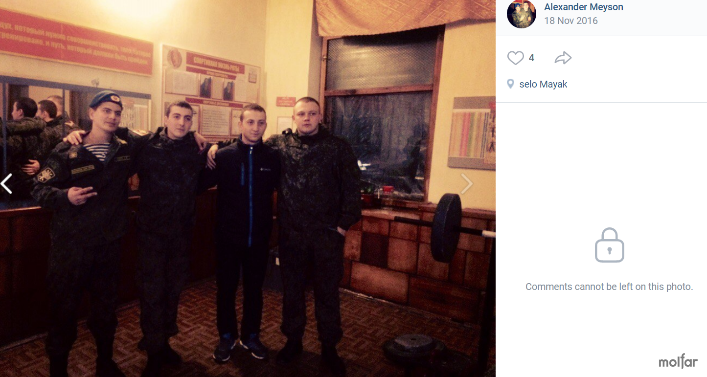
Between 2016 and 2019, an asphalt road was laid to the military town located a few kilometers away, confirming Russian military personnel's regular use of these facilities. In early July 2023, several photos were published in the "Excursions in Crimea from Sevastopol" (Russian — Экскурсии по Крыму из Севастополя) group on VKontakte, showing vacationers taking pictures in front of the military town.
Many photos of these facilities were also posted on social media by Russian military occupiers. For example, Alexander Mason repeatedly posted pictures from there in 2016, even tagging the geolocation near the military town (1, 2, 3, 4, 5, 6, 7, 8, 9).
So, what are radar systems?
Russian radar complexes (RLC) are systems designed to detect, track, and identify various objects in the air, on the ground, and at sea. They are used for airspace security and threat detection.
The RLCs "Nebo-U," "Nebo-SVU," and the low-altitude radar "Kasta-2E2," deployed at Cape Tarkhankut, are modern systems capable of detecting targets at long distances and high altitudes.
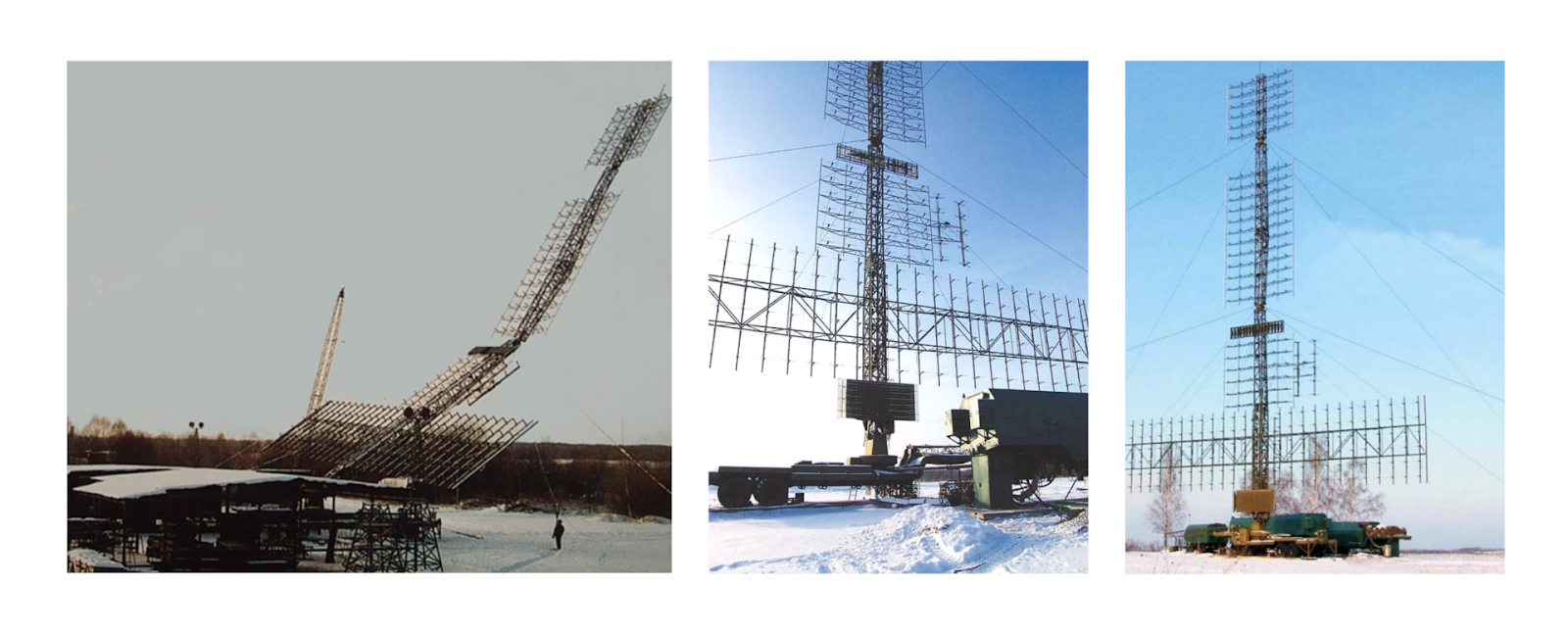
"Nebo-M" ("Nebo-UE") is a mobile multi-band radar complex. It is designed to detect and track air objects of various classes, including ballistic missiles and UAVs developed with stealth technology.
It consists of a meter-wave range radar module — RLM-D ("Protivnik-G"), a centimeter-wave range radar module (not identified at the site as of 2016), and a control cabin.
Furthermore, it has been supplied to Russian forces since 2012. Additionally, in 2016, the user starcom68, referenced in the mentioned article, photographed the "Nebo-SVU" radar at its location.
Detection range for a fighter-type target: at an altitude of 20 km — up to 380 km; at an altitude of 500 m — up to 65 km. Deployment/withdrawal time: approximately 30 minutes.

"Kasta-2E2" is a low-altitude three-coordinate Russian surveillance radar designed for airspace control. It can determine the range, azimuth, altitude echelon and track characteristics of aerial objects such as airplanes, helicopters, UAVs, and cruise missiles. According to Russian sources, it can detect up to 50 aerial targets in a 360-degree sweep up to 150 km. The 14-meter antenna detects targets at an altitude of 60 meters and a range of 30 km. Another variant of the antenna, measuring 52 meters, detects targets at a range of up to 95 km. It is also claimed to be capable of detecting 5th-generation fighter jets like the F-35.
What is a "radio-transparent dome," and how does it protect Russian radar systems?
A radome, or radio-transparent dome, is a structure that covers the antenna of a radar station or other transmitting devices. The primary function of this dome is to protect the antenna from external factors, such as weather or drone attacks, while ensuring minimal absorption and reflection of radio waves.
It is likely that the radars were covered with domes in 2019-2020, possibly as part of preparations for Russia's full-scale invasion of Ukraine. Another reason for this decision could be the high number of tourists in the area. Notably, less than a kilometer from the largest dome is a popular tourist attraction, the "Thinker Monument." Photos often capture the radars located nearby (1, 2, 3).
Near Feodosia, a 55Zh6U "Nebo-U" radar was installed under such a dome. The antenna was identified and photographed in 2016 by user starcom68 (1, 2, 3).
Why did the Russians hide their radar systems under domes?
- Similar Practice in the USSR. During the USSR era, antennas of this particular radar system were placed under radio-transparent domes. For instance, there was such a radar system under a dome near Feodosia, also known as a "space surveillance station" (1, 2, 3).
- The Dome Appeared in 2019-2020. It is likely that the Russians created it in preparation for a full-scale invasion of Ukraine. It seems they wanted to protect critical equipment from potential Ukrainian Armed Forces attacks on occupied Crimea.
- Cape Tarkhankut — is a Tourist Location. People often take photos here with the "Monument to the Thinker." Usually, they post pictures taken from the "right" angle — with a view of the sea, leaving the domes behind the photographer's back. However, the military object itself sometimes appears in the frame, which helped Molfar analysts in fact-checking the strike on this site.
- "Nebo-U," "Nebo-SVU," "Kasta-2E2" — Modern Known Radar Systems. These are the latest developments of the Russian military-industrial complex. They were deployed in the occupied Crimea as early as 2016. Therefore, these are obviously priority objects for protection.
Who manufactures radio-transparent domes in Russia?
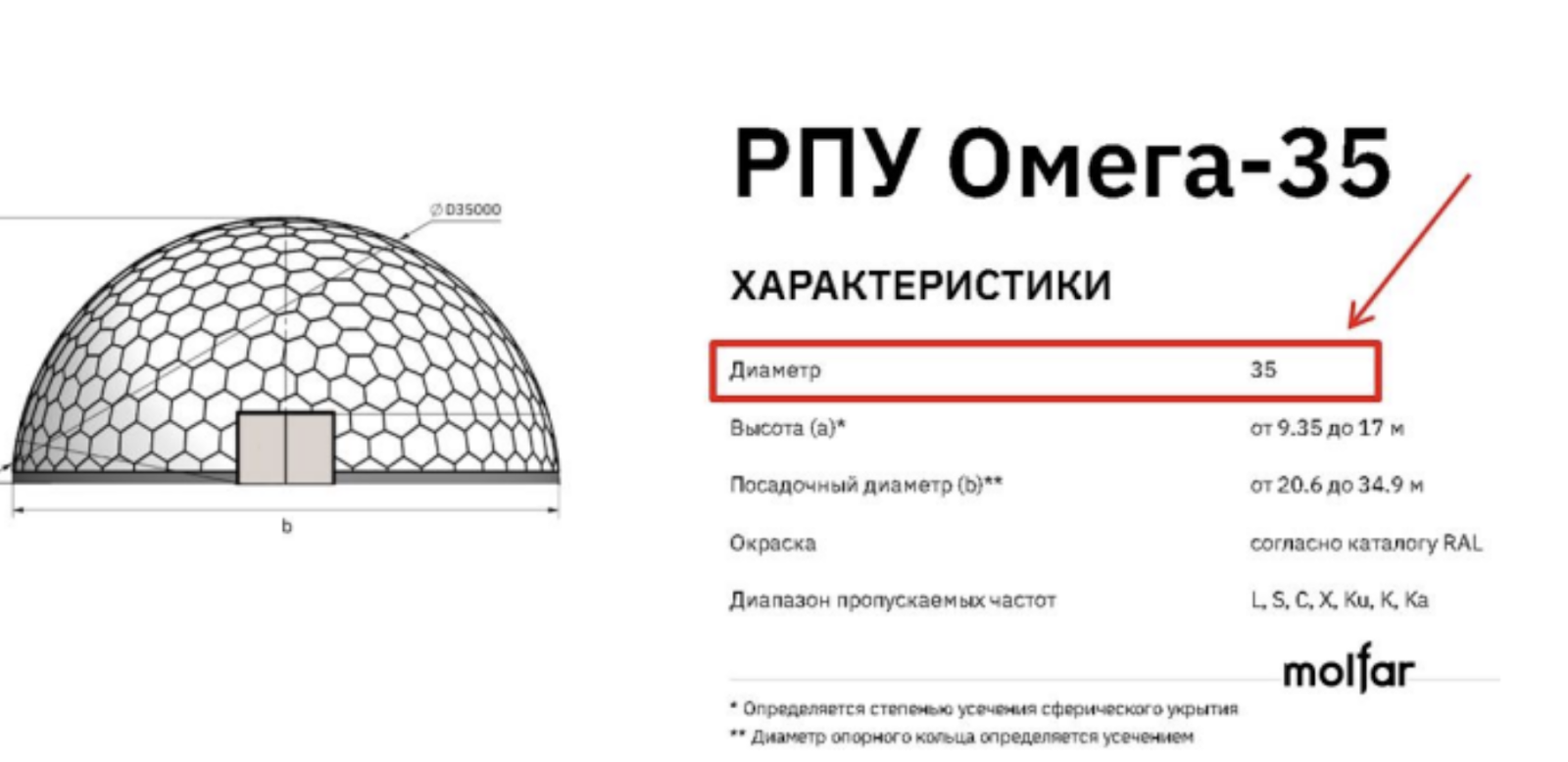
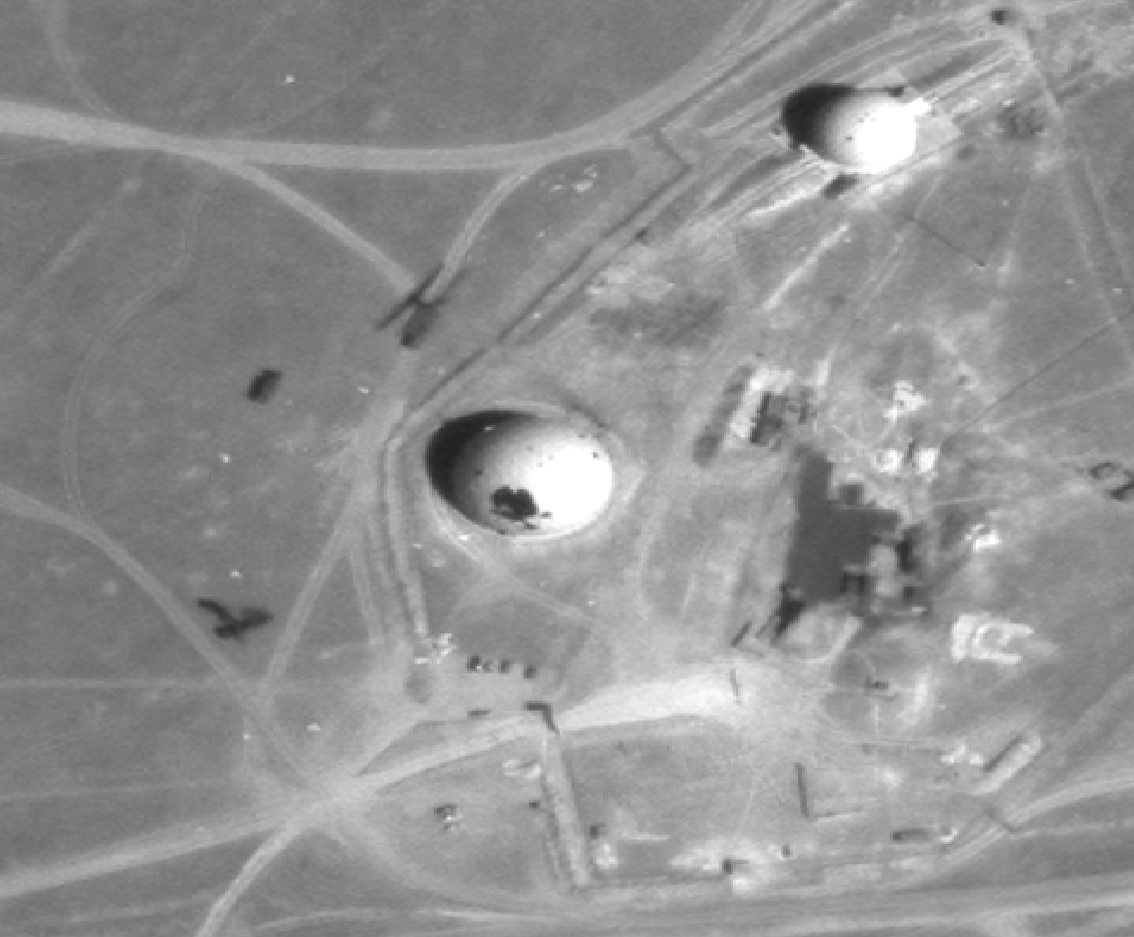
Such radio-transparent shelters (RTS) at Cape Tarkhankut are likely produced by the Russian scientific and industrial association "Radiovolna" (Russian — НПО "Радиоволна"). According to information on their official website, the company has patented technology for manufacturing RTS with diameters ranging from 1 to 35 meters.
It appears to be the RTS Omega-35.
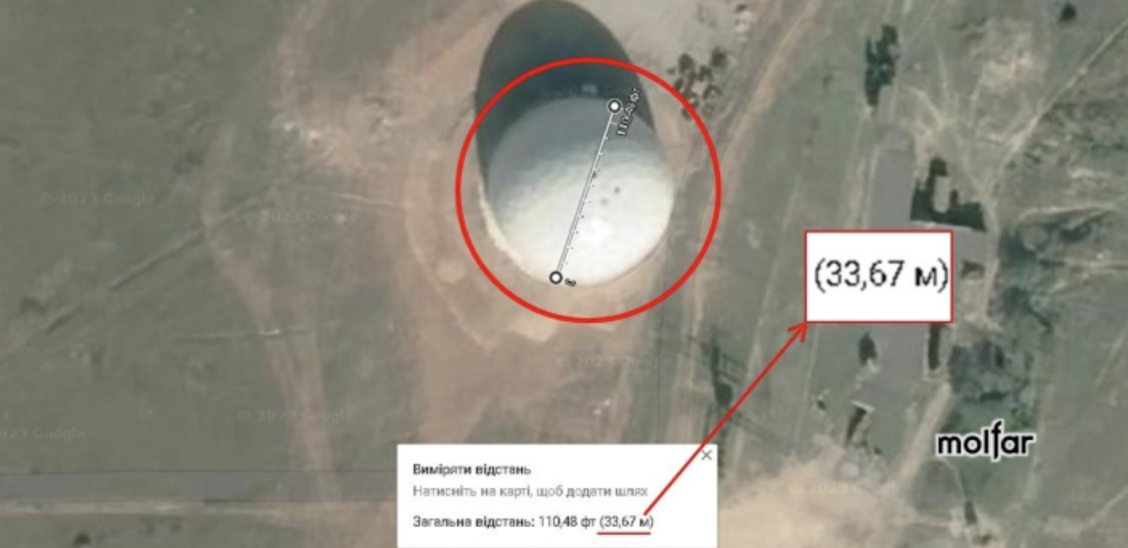
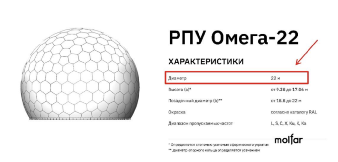
The second dome at Cape Tarkhankut is slightly smaller. Using the standard ruler tool from Google Maps, its approximate diameter was determined to be nearly 22 meters.
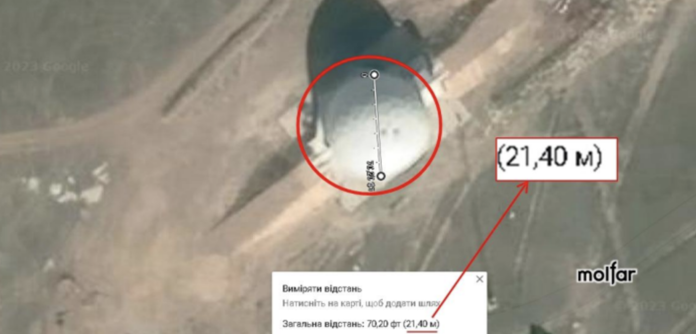
Next to the previous one is another dome. Its approximate size, based on measurements, is 21.40 meters. It is likely the Omega-22 RTS. The coordinates for Dome №2 are 45.346471, 32.522057.
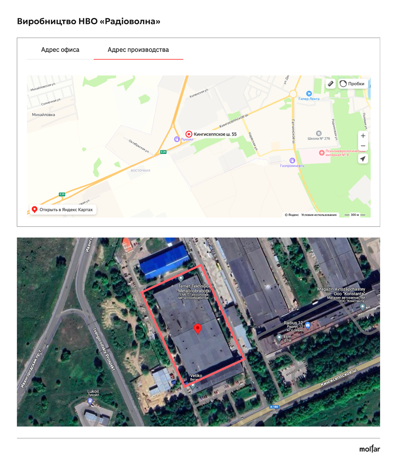
"Radiovolna" is a Russian enterprise in the radio engineering industry, specializing in the development and production of products made from radio-transparent materials for both civilian and dual-use purposes. Radio-transparent shelters are their primary product. The company's office is located in St. Petersburg, Kozhevennaya Line 1-3, building P, office 1N.
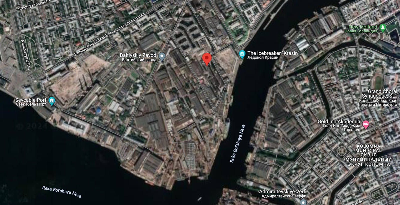
The production facility of NPO "Radiovolna" is located in St. Petersburg, Krasnoselsky District, Kingisepp Highway, 55.
How was the dome at Tarkhankut damaged? One of the latest such attacks was a night operation on April 28, 2024. According to the propaganda resource "Rybar," the attack was carried out using ATACMS tactical missiles with cluster warheads. The target of the attack was allegedly air defense units stationed in the area.
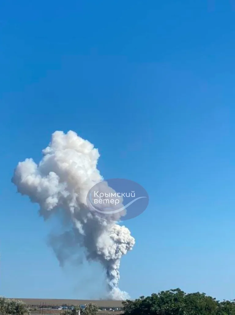
On August 23, 2023, explosions were heard at Cape Tarkhankut. Local Telegram channels reported that around 10 a.m., Russian military facilities were damaged. According to testimonies from residents of Olenivka, a nearby settlement, four Russian fighter jets flew towards the cape after the explosions.
The following day, at dawn on August 24, Ukrainian military personnel from the Main Directorate of Intelligence landed in the Cape Tarkhankut area.
On June 11, 2023, Radio & Nukes published satellite images of the larger dome on Twitter, taken on June 5, 2023. The photos show a black spot, which is likely a hole caused by an impact.
At the same time, other users reported optical distortions in satellite images from earlier in May 2023. It is likely that the dome was shelled in April 2023, as there were reports of shelling in the Feodosia area, where similar domes (1, 2, 3) housing the 55Zh6U "Nebo-U," 57U6 "Periskop-VM," and "Nebo-T" radars are also located. Nearby is the radar node of the 3rd Radio Engineering Regiment on the Tepe-Oba ridge.
Russians posted photos of domes on social media, confirming the strike.
As we mentioned above, this site is located very close to a tourist spot that attracts dozens of visitors who take photos with the "Thinker Monument," and the "dome" often appears in these photos.
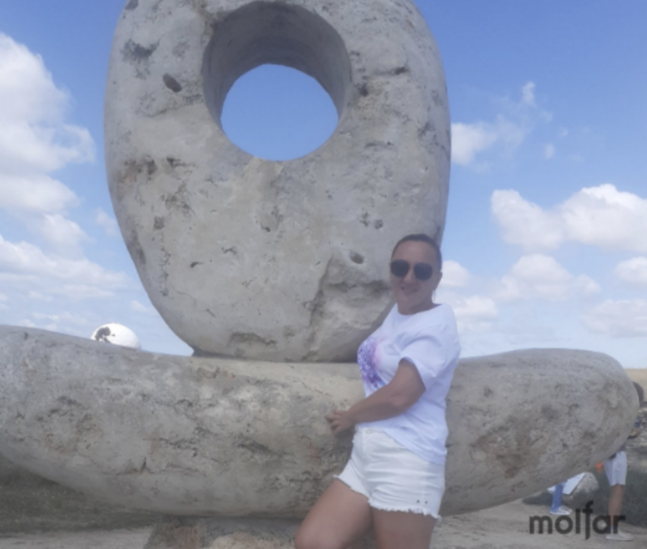
A photo dated July 28, 2023, was published by a user named Lesya Vladimirovna on the Russian social network VKontakte. She was photographed next to the "Thinker Monument," and in the background, the damaged dome can be seen.
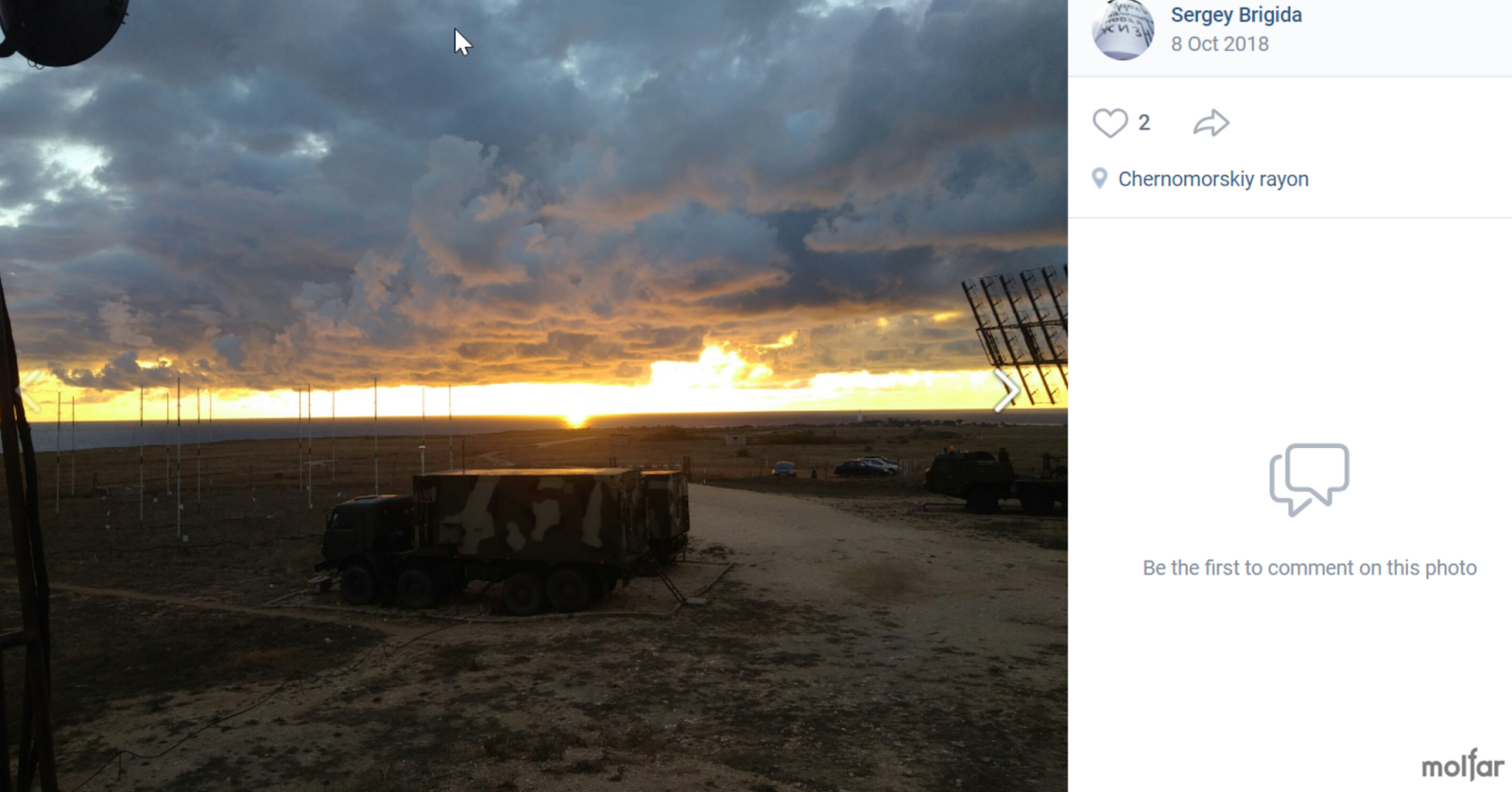
Another Russian, Sergey Brigida, in October 2018, published photos (1, 2) on his VKontakte page. He is shown in military uniform next to the tourist attraction "Thinker Monument." This is the same sculpture where Lesya Volodymyrivna was photographed.
In June 2018, Sergey also posted photos (1, 2, 3) with geolocation points indicating the military town area. In October 2018, he published photos (1, 2) with geolocation points near the domes.
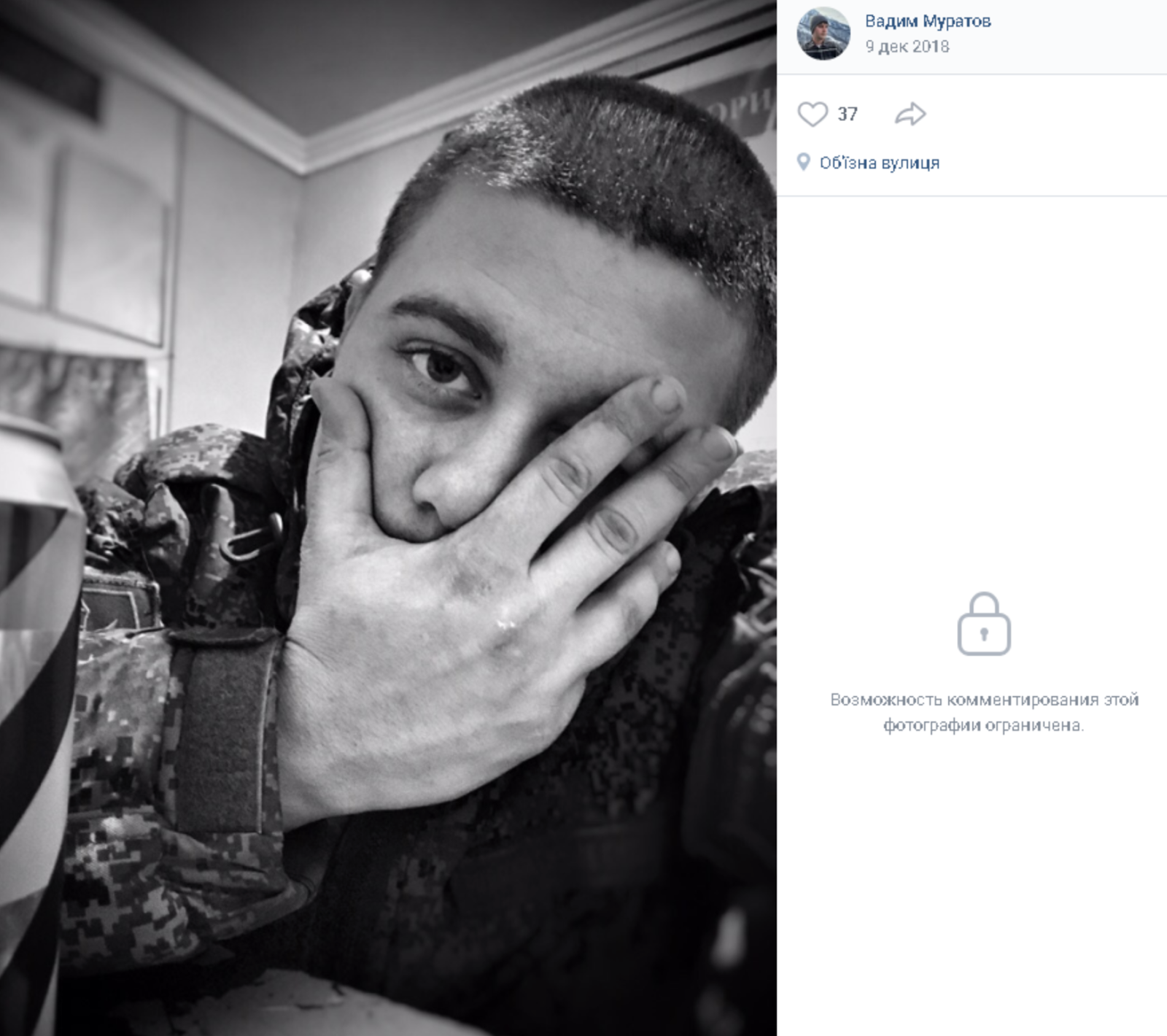
Russian soldier Vadim Muratov, with geolocation indicated, published a photo in the military town.
Another user on the Russian social network, Anatoliy Kozyrev, published photos (1, 2, 3, 4) on his page in August-September 2022, showing the Tarkhankut Lighthouse in the background of a military town. The photos also captured satellite antennas that could be used by the Russian military. This confirms the use of the territory by the military during the full-scale invasion.
Cape Tarkhankut, where the Russian occupiers have deployed the "Nebo-M" and "Nebo-SVU" complexes, is a critical element of Crimea's air defense. The terrain allows for the placement of Russian radars, which are hidden under radio-transparent shelters. These complexes enable the occupiers to control the airspace over the Black Sea and the bordering NATO countries — Turkey, Bulgaria, and Romania. A similar situation exists with the radars on the summit of Ai-Petri, which were recently hit by Storm Shadow. The Russians hope to hide their air defense systems from strikes, but will it work?